
 Area Calculator
 Kansas City Public Library
Kansas City Public Library. Location on an interactive map and geographic coordinates.
Coordinates (latitude/longitude):
39.10224365275894-94.58411378515717
Location:
139-199 W 10th St, Kansas City, MO 64105, USA
Loading map...
Kansas City Public Library is one of the largest libraries in the world. The number of books is 2.5 million copies.
The library has a unique facade. It is made in the form of a bookshelf. Each of the 'book' has a width about 2 meters and height 7 meters.
The library has a unique facade. It is made in the form of a bookshelf. Each of the 'book' has a width about 2 meters and height 7 meters.
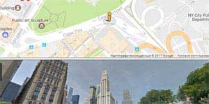 Map and Street View
 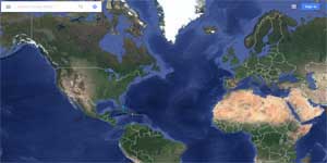 How the satellite maps are made
 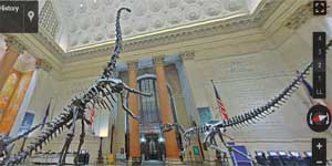 American Museum of Natural History
 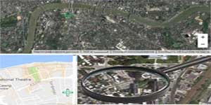 'Magnifying glass' for satellite images
 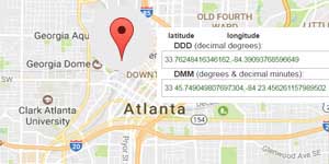 Determine the coordinates on the map
 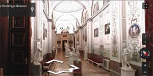 The State Hermitage Museum
 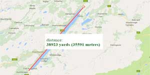 Google maps to determine the distance
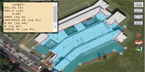 Area calculator tool by Google maps
 Determination of peaks' altitude above sea-level or both oceans' and seas' depth